Chuchu Qi a.k.a. Chuchu
selected works [landscape]
Visualizing Carbon Sequestration
Sign Design
for testing and raising awareness in public space
Critic: Micah Stanek
Fall 2020 | Landscape Architecture Graduate Elevel Elective
St. Louis, MO
The project focuses the visualization of the carbon sequestration strategies in Forest Park, STL, between the Normank Probstein Community Golf Course and the Kennedy Forest. Inspired by the NYC reforestation project, the matrix illustrates the possible ecological knowledge of carbon storage in urban landscape. The nine diagrams demonstrate the different carbon storage methods, including soil, rock, concrete, biochar, peatlands, ocean, forest, coastal vegetation, industry.
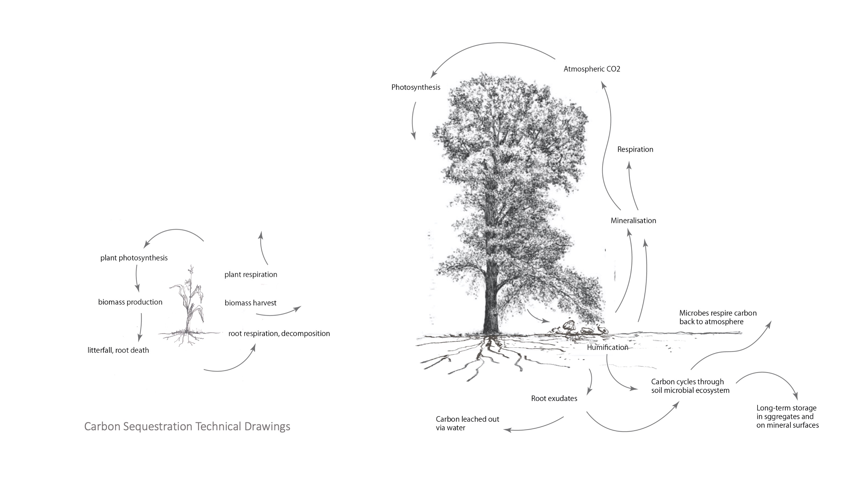
Hand-drawing of Carbon Sequestration Process

Index of Carbon Sequestration Strategies
Public space is shaped by design but also by political, social, and environmental dynamics. Ecological design, especially on public land, requires alignment of various values, desires, and systems. One factor that limits the cultivation of a more ecological urbanism is the knowledge gap about urban ecological systems. Urban ecology research is on the rise, but experiments sometimes come into tension with the public. This course located excellent examples of ecological design from history to the present, discusses the role of the advocacy and public awareness, and speculates about how design could further collaborate with ecology.
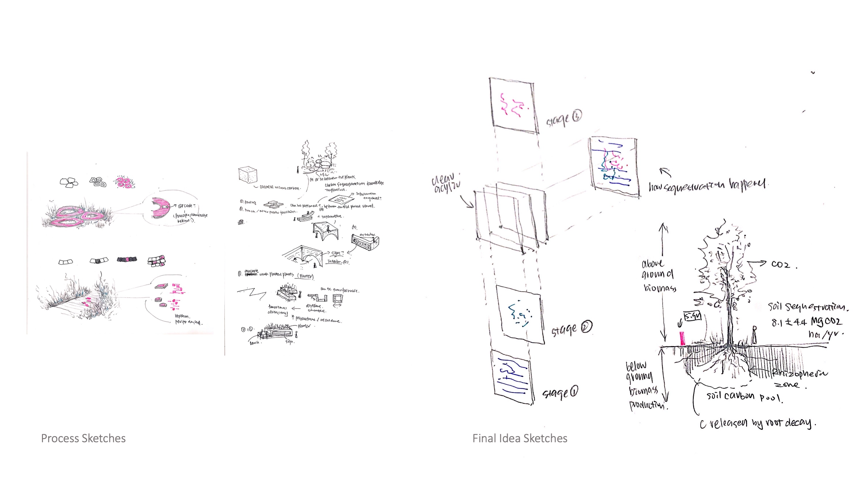

Sketches and Rendered Sample Prototypes
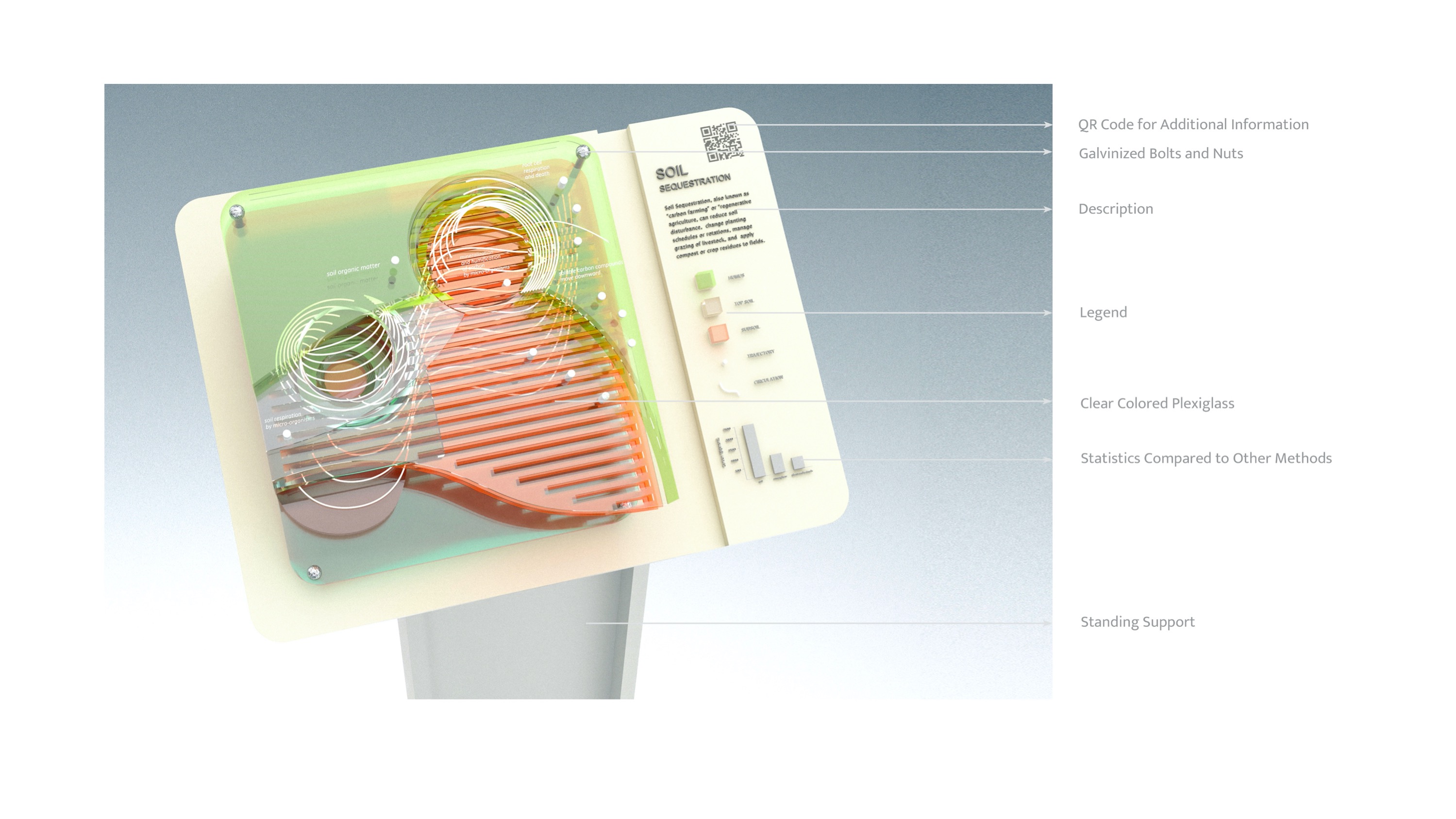
Sample prototypes show the transformation from the index diagram to the sign, using the dynamic color to tell the carbon sequestration strategies in different landforms. For example, the blue layer implies the water region, red represents the soil, and green is the grassland. These prototypes provide the fundamental experiment toward the final sample sign about the transparency of the material and the arrangement of the layers.

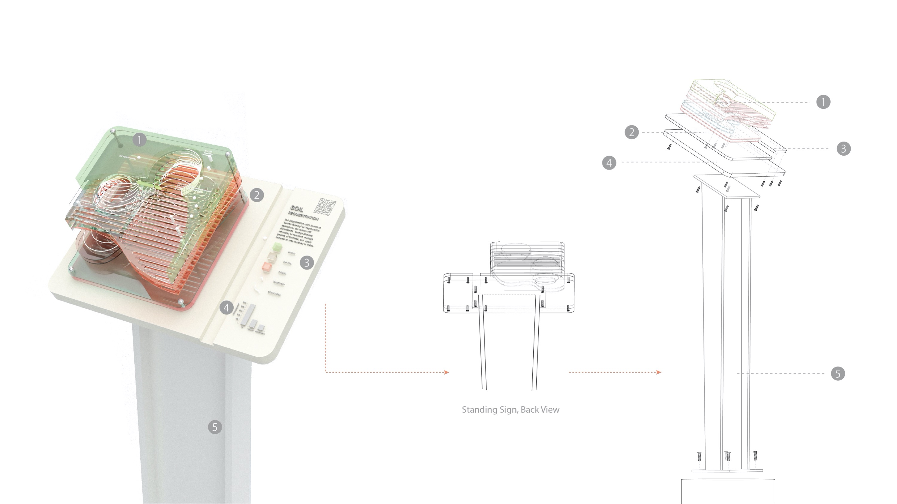
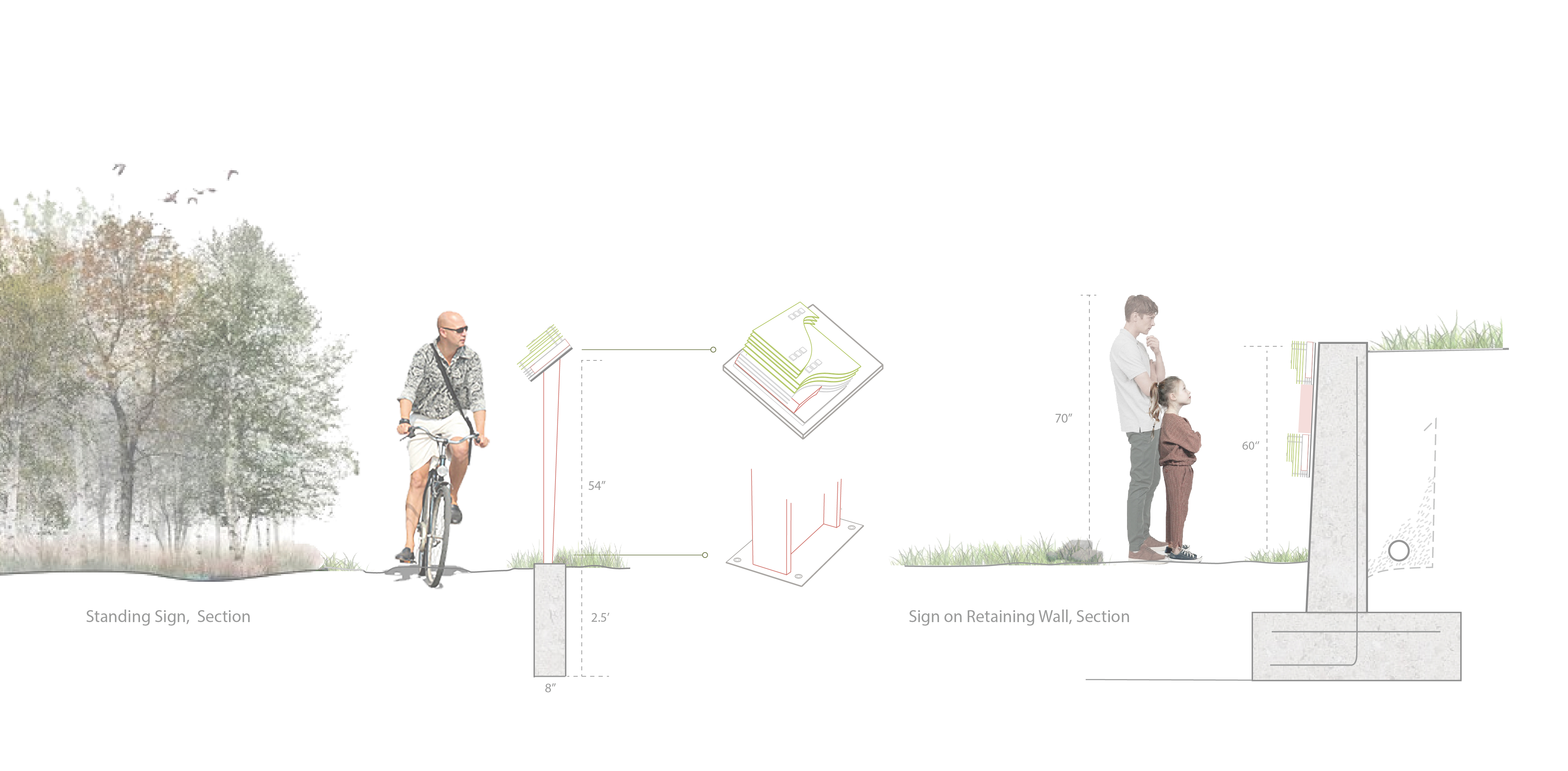
The combination of units for retaining wall shows how the units can be put together vertically side by side besides the way of standing sign, providing the audience with a holistic view of the carbon sequestrations of the site.

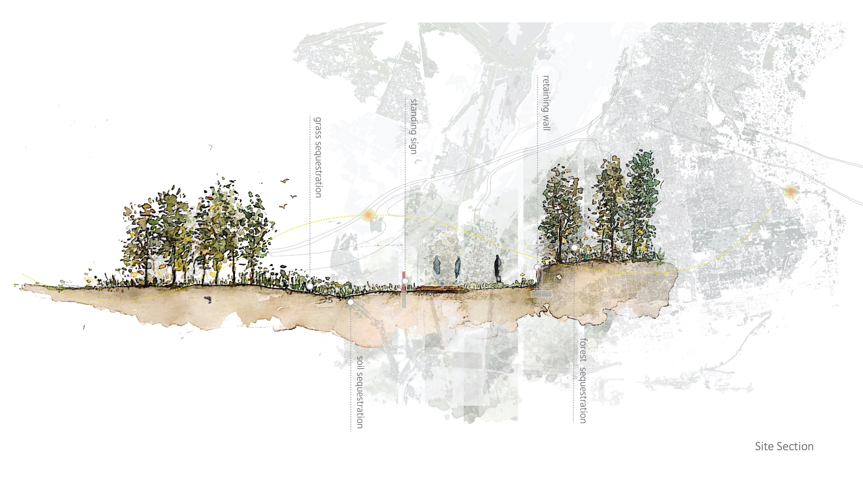
The final rendered sign is a visualization of the existing carbon sequestration strategies in Forest Park. The sample rendering of the standing sign shows how the soil sequestration happened by assembling the plexiglass into the form of the topography. Moreover, the histogram offers a comparison of the carbon storage amount between the soil and atmosphere, animals, and plants, showing the advantage of the soil sequestration strategy. In addition to the general description paragraph, the audience can also gain more information about the soil sequestration knowledge by scanning the QR code on the corner of the sign, which leads to the existing online platform created by FAO.